OpenCPN
About
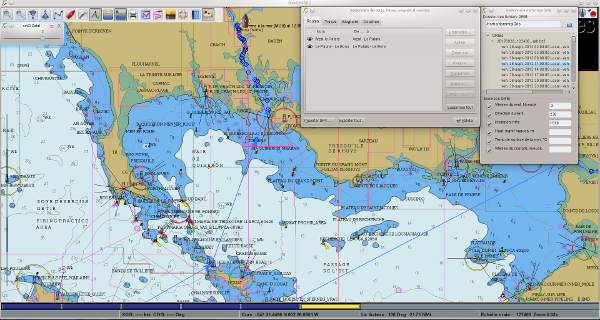
OpenCPN is a free software (GPLv2) project to create a concise chart plotter and navigation software, for use underway or as a planning tool. OpenCPN is developed by a team of active sailors using real world conditions for program testing and refinement.
Current release see OpenCPN Web site
-- Installation is done via Flatpak.

Features
- BSBv3 raster and S57 ENC chart support.
- CM93 vector chart support, with per cell offset corrections.
- IHO S52 compliant display of S57 vector charts.
- Single-chart and Quilted display modes.
- North-up, Course-up and Chart-up display modes.
- Moving-map display mode.
- Route navigation with ship tracking functions.
- Waypoint navigation.
- Dashboard for configurable on-screen display of ship's NMEA data.
- NMEA 0183 GPS interface at selectable baud rate.
- OpenGL support for enhanced performance on modern hardware.
- gpsd library support.
- Autopilot output support.
- AIS input with full target tracking and collision alerting.
- AIS support for SART, DSC and GPSGate Buddies.
- Anchor watch/alarm functions.
- GRIB file input and display for weather forecasting.
- GPX Waypoint, Track and Route input and output file support.
- Route planning with tidal support.
- GPX Layers for annotation of charts.
- Tide and Current prediction and display by location.
- A growing number of plugins. Google Earth, World Magnetic Variation, Voyage Data Recorder, AIS -radar and a LogBook.
- Multi-language support.
- Plugins (Linux compatible list only)
Supported releases
Official release
Package for OpenSUSE are not built anymore on OBS. You must use the OpenCPN Flatpak installation process.
Plugins
Plugins are now loaded from OpenCPN application. Key plugins are listed bellow.